
Red Squirrels Northern England (RSNE) uses data from a variety of sources to produce regional maps. The two 2018-2020 maps below are the latest to show where red squirrels are still present across northern England, and some of the associated grey squirrel management work undertaken to ensure their conservation.
Red Squirrel Range in Northern England 2018-2020
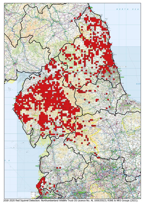
This 2018-2020 RSNE map shows where red squirrels are still present across northern England. It displays red squirrel detection in 2km squares, combining red squirrel sighting records collected from community and red squirrel groups, and from RSNE project work and monitoring.
Grey Squirrel Management Footprint in Northern England 2018-2020
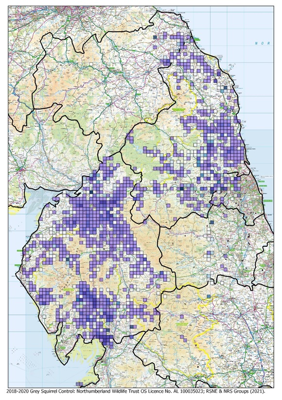
This 2018-2020 RSNE map again uses 2k squares, this time with colour shading, to display the range and intensity of grey squirrel management work undertaken by those involved in the effort to protect our red squirrels. Data from a variety of sources have been combined to produce these results, including from community groups and RSNE itself.
These maps are reproduced with the kind permission of Red Squirrels Northern England (RSNE), a project partnership between the Northern Wildlife Trusts, Forestry Commission, Red Squirrel Survival Trust and Natural England. They were first published in RSNE’s 2021 Spring Squirrel Monitoring Programme Results, which can be accessed here>>


